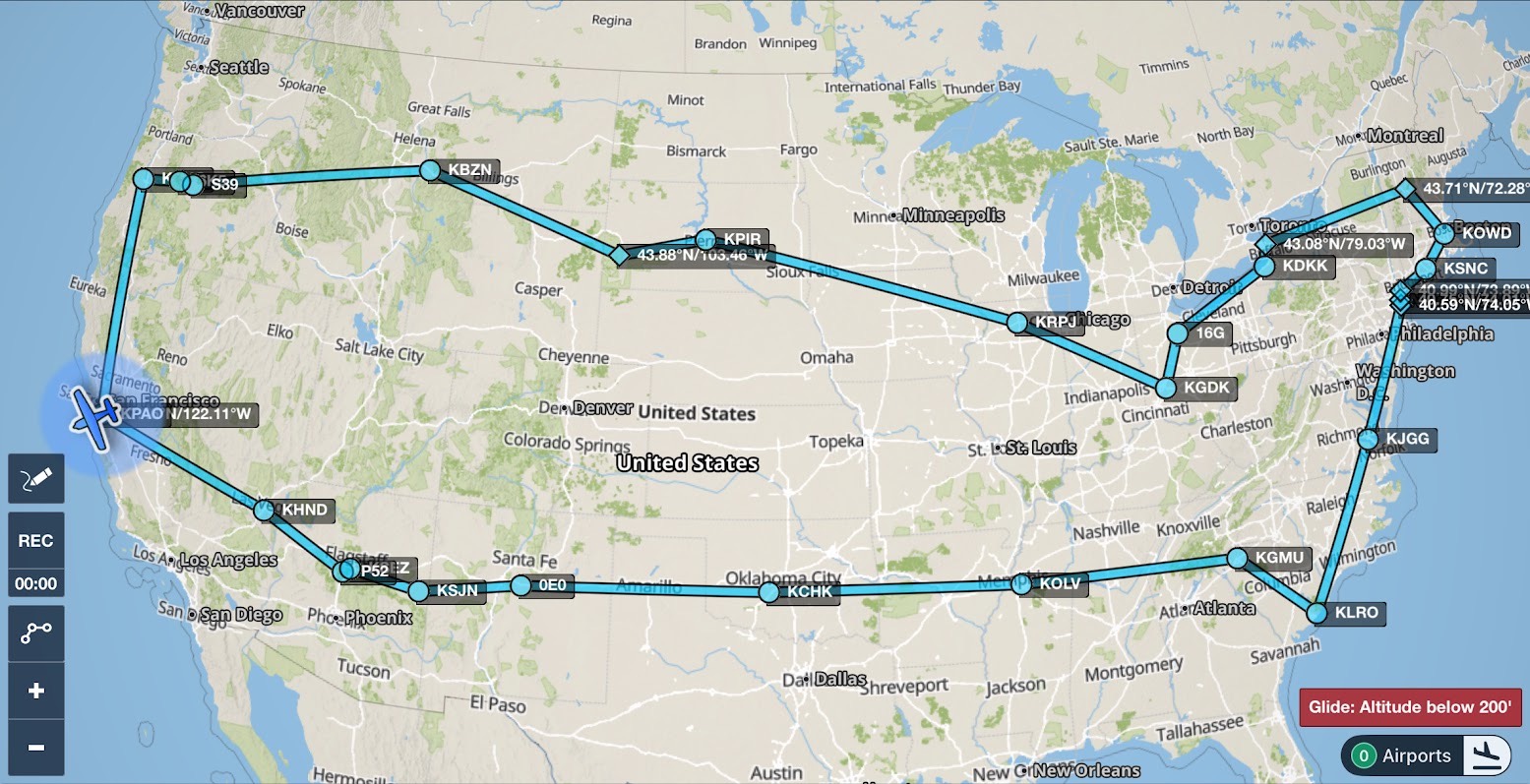
The Big Loop
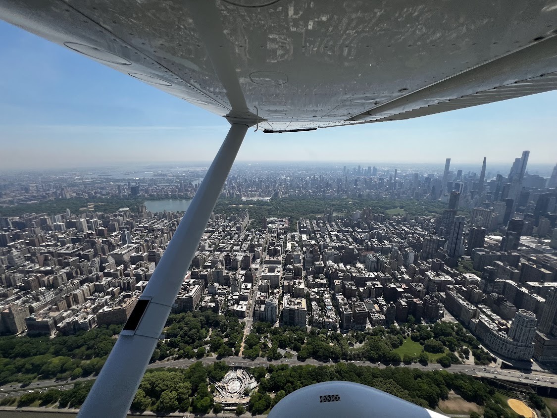
The G1000 was blaring “Obstacle! Pull up! Obstacle! Pull up!”. But it wasn’t a mountain of granite looming ahead. It was the glass and steel of the Freedom Tower in New York City. The date was May 18, 2026, and we were roughly halfway through a PAO-to-PAO loop taking us to the four corners of the US. We’d just been cleared to fly the Manhattan “Skyline Route” at 1500’. I was giddy with excitement as we flew up the Hudson River watching the skyscrapers slide by so close that we could see people on the balconies.
The idea of a coast-to-coast flying adventure had been in my mind for a few years. My wife and I had flown all over the western US since getting my PPL in 2018, and I’d flown to Oshkosh in 2025. A full loop of the US seemed like the next step, and with several adult children living on the east coast, we had reasons to go. But for the trip to really be worth it, we needed more people to visit, sights to see, and things to do on the way out and back.
A few years back I opened a Google doc and titled it “Dreaming of an East Coast Loop.” I started listing all the places we have family; national parks we could drop in at; attractions worth visiting; targets for aerial photography; funky airports that AOPA magazine highlighted. It wasn’t long before there was too much to do! Ohio alone was overloaded with the Rock and Roll Hall of Fame in Cleveland, the famous Cedar Point amusement park in Sandusky, the National Museum of the U.S. Air Force in Dayton, my mother’s hometown of Tiffin, and did you know that Sporty’s offers a free barbeque every Saturday to anyone dropping in at their home airport, I69 in Batavia? After all the money I’ve spent with them, I was really excited about a free hot dog.
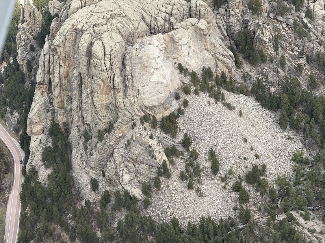
Alas, the problem wasn’t finding things to do– it was pruning the list. We didn’t want to be “on the road” for more than 25 days, so we had to make hard choices. Family came first, and we visited 9 different sets of relatives in Arizona, New Mexico, Mississippi, South Carolina, Virginia, Boston, and Oregon. Then there were the aerial and aeronautical must-do’s, like landing on the mesa at Sedona Airport (KSEZ), visiting the Wright Brothers Memorial at Kitty Hawk (KFFA, which sadly we had to skip for weather), buzzing the New York skyscrapers, overflying Niagara Falls, seeing Mount Rushmore, and touring the Air Force Museum.
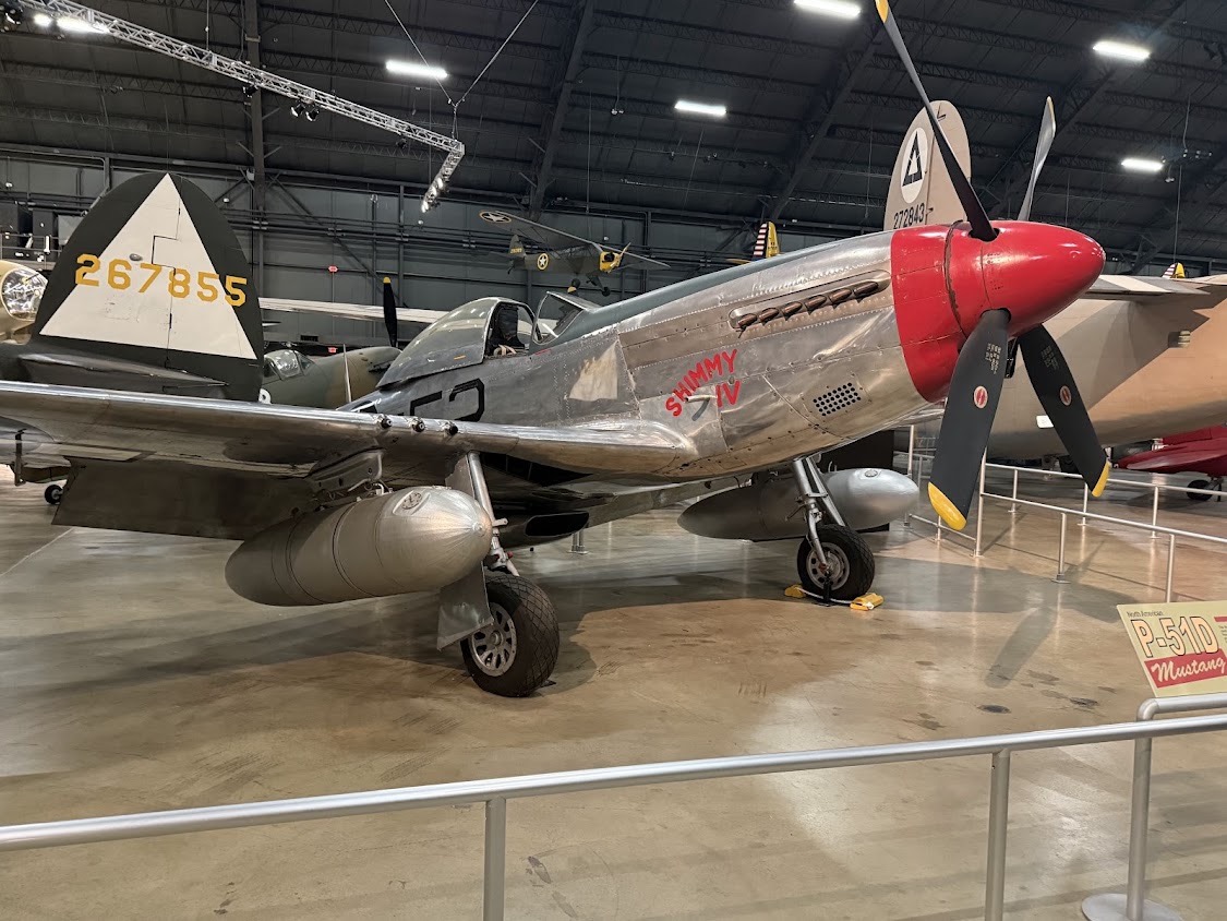
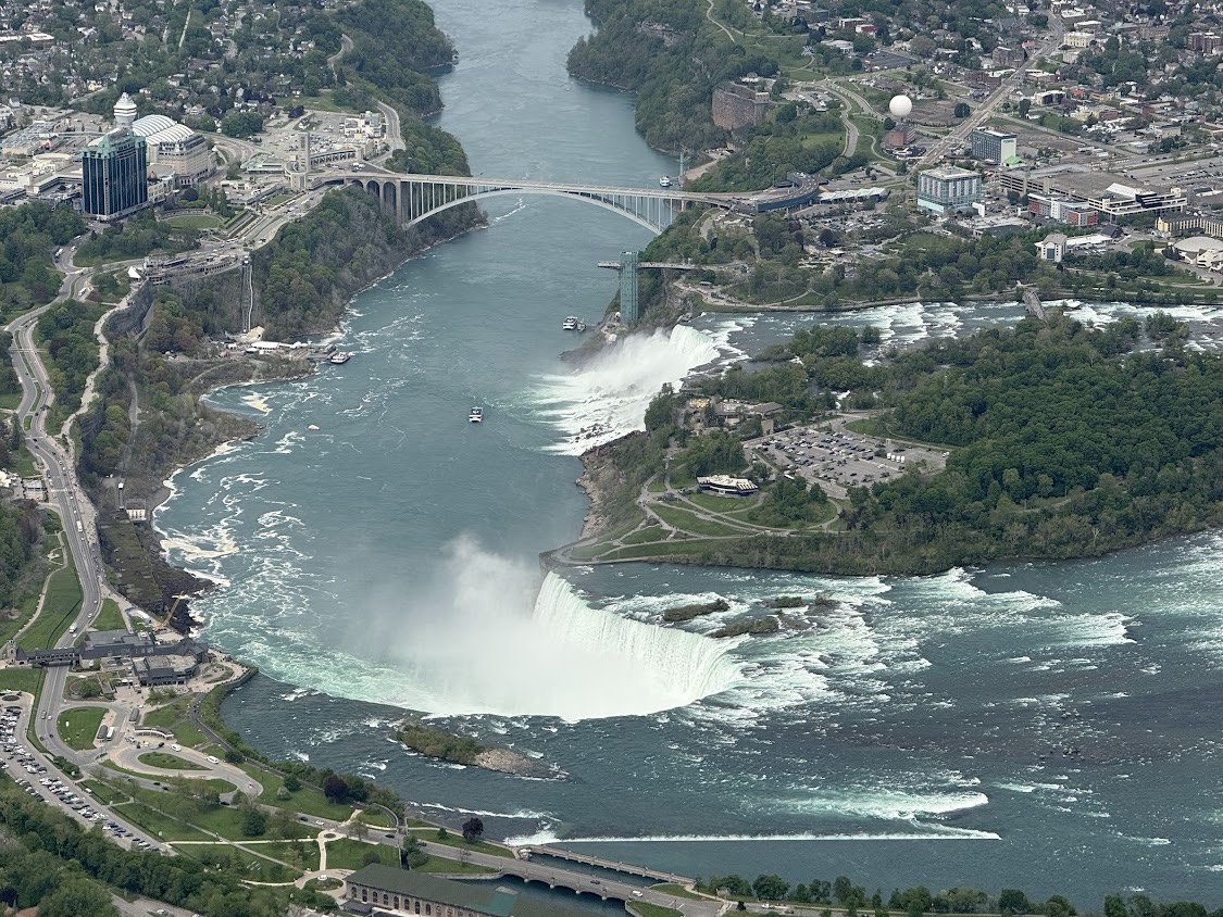
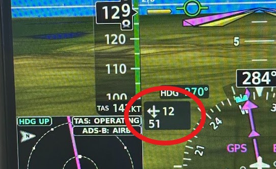
We set out from Palo Alto on May 4, with a detailed itinerary and a sincere readiness to adapt as needed. We tried to fly no more than 4-5 hours a day, and to spend two nights in the same spot whenever possible. Our longest day was 6.5 hours, from Boston to Ohio, with aerial photography of Dartmouth College and Niagara Falls along the way, slowed by a 51 knot headwind at times. The shortest day was 20 minutes, hopping from one small Oregon airport to another. It seemed like as soon as we landed each day, I was looking ahead and flight-planning for the next few legs.
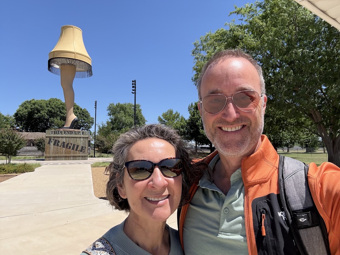
It was great to see family, but I also loved the small airports and small towns where we’d stop to fuel up or spend the night. Seems like the smaller the airport, the friendlier the people. I called ahead to Chickasha, OK (KCHK) to confirm that their $5 gas was for real, and the airport manager said he’d have our car waiting, and sold us on the virtues of Chickasha (rhymes with “ricochet”), including their 50-foot “leg lamp” roadside attraction.
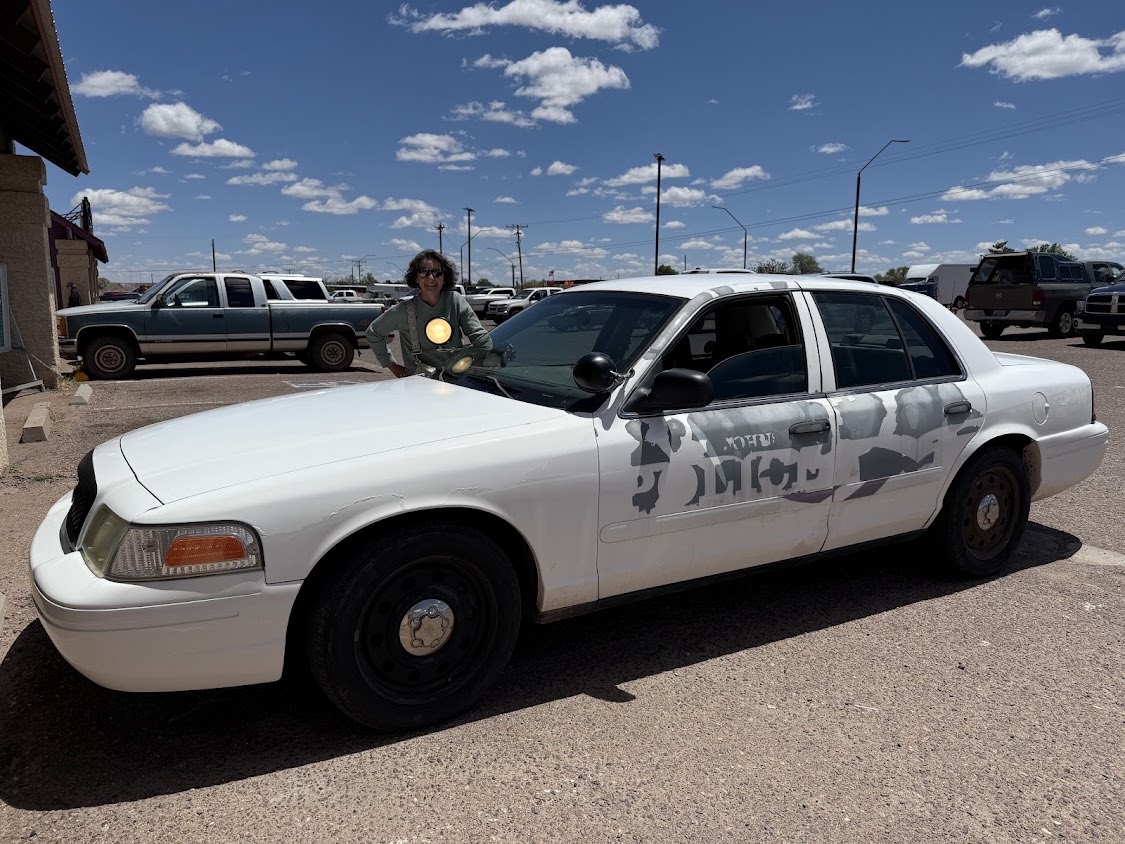
I love courtesy cars. We borrowed eight of them, ranging from a brand-new black Chevy Tahoe, in Bozeman (KBZN), to a retired police cruiser with the official decal only half peeled-off and a working spotlight, in Saint John, AZ (KSJN). Four times, I called ahead, said we’d be arriving after the FBO closed, and got them to leave the keys under the mat and let us keep the car overnight. People in General Aviation are just plain nice.
We learned a lot on this trip. Here are a few tips you may find useful.
The East Coast is Flat: In the West, every flight plan must consider terrain and how to handle an engine-out. Not so much out there. One day we had overcast ceilings at 3000’ along our entire route. No problem. We just flew at 2000’ the whole five hours, and had all the engine-out options we needed.
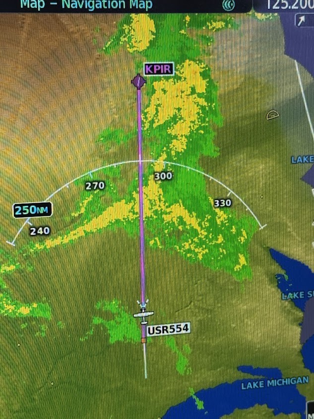
The East Coast Has Weather: Just how bad are green, dark green, yellow, and orange dots on NEXRAD weather? What can you fly through, and what should you go around? I didn’t have much experience flying through rain, so we had to get calibrated. We started by flying into green, and then yellow, prepared to turn around if we weren’t comfortable, but learned that they were quite manageable. Yellow is solid rain, enough to power-wash the bugs off the leading edge of the wing. We didn’t experience orange, but I suspect that may be more intense than we’d like.
Time Zones: This is kind of embarrassing, but I made the same mistake three times, telling family we’d arrive by 6pm, only to realize they were in the next time zone, so it would really be 7pm. Learn from my mistakes.
Packing: On past trips, we’ve toted a large assortment of small bags and duffles, making it awkward to move from plane to car to hotel. This time, the problem was about to get worse, since we packed more clothes for longer stretches without doing laundry, and also needed nicer sport coats and dresses for a graduation and a wedding reception. We came up with a good solution, though. We each brought one rollaboard-sized suitcase, plus a 10 gallon storage bin (from Home Depot) which stayed in the plane. We called these bins our “dresser drawers”. We’d periodically swap clothes between the bins and our suitcases, so at each stop all we needed was the roller bags. The swapping happened on the ramp during gas stops, so we were ready to roll when we landed at each destination. More than one family member exclaimed, “That’s all the luggage you have?”
We also organized the back seat of our Cessna 182 for comfort. We had oxygen and cannulas within reach, a big box of snacks, and a small garbage bin for wrappers, peels, and empty oil quarts.
Fuel: ForeFlight’s new “Fuel Price” layer was invaluable. We were able to choose our lunch stops to optimize for cheap gas, and ended up averaging $6.25/g for the whole trip, at a time when PAO was charging $8.40.
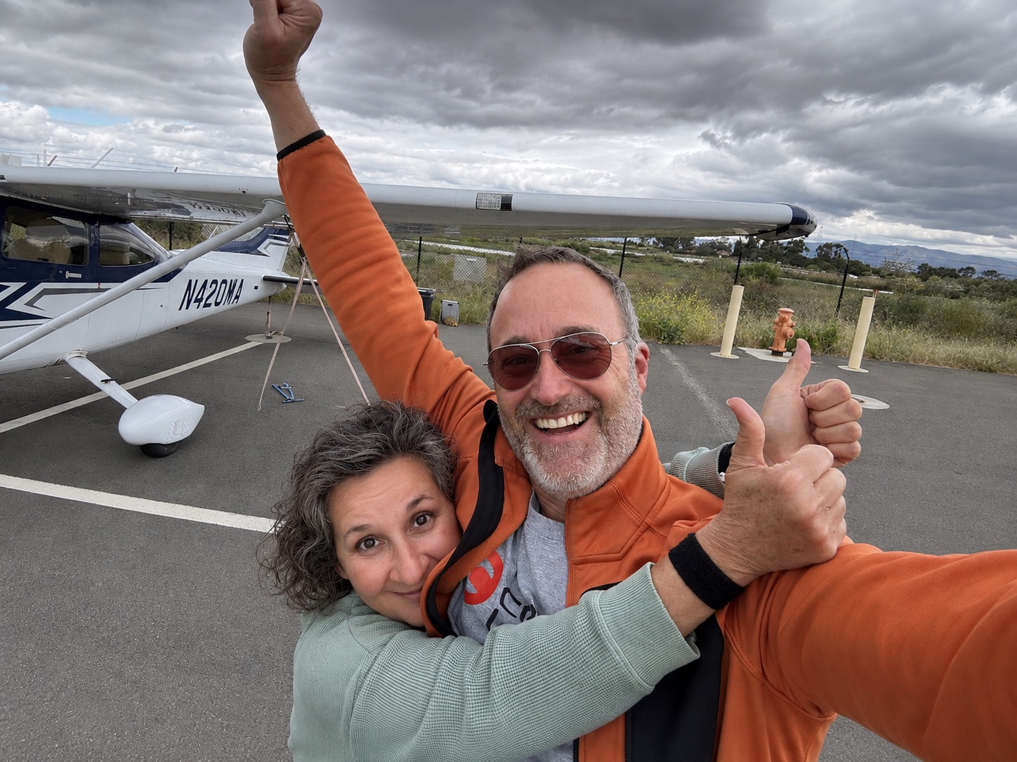
We landed safely at KPAO, 25 days after we started. The plane was a champ, with zero mechanical problems along the way. We had flown more than 6,000 nautical miles, landing at 21 airports in 14 states, putting 55 hours on the Hobbs, purchasing 618 gallons of fuel (ouch!), and adding 10 quarts of oil along the way.
I earned my pilot license to enable new adventures, and this was my biggest flying adventure yet. I hope it inspires you to plan a big adventure of your own! If you’d like to see a larger set of photos, including our exact route and more aerial photography, check out our album here.